Omniscape Impact: a new tool for assessing the effects of habitat restoration on ecological connectivity
ApexRMS
31 January, 2024
By Sarah Chisholm
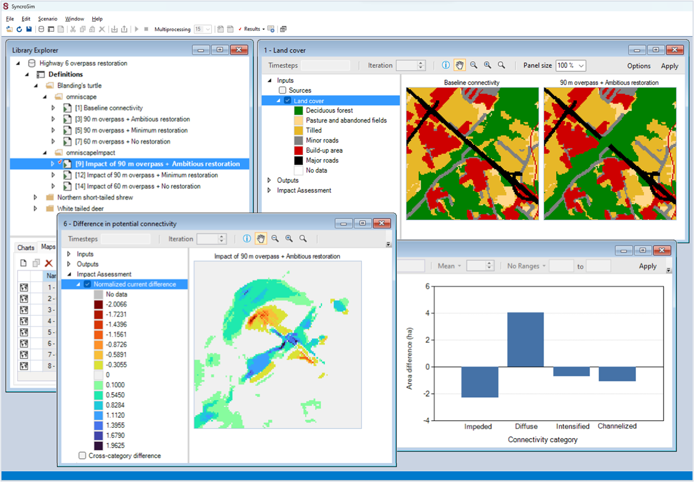
Example of the Omniscape Impact tool applied to a possible future habitat restoration scenario: the creation of a highway wildlife overpass (top right map). The impact of the proposed restoration is measured against a “status quo” baseline, showing a projected increase in habitat connectivity crossing the highway (bottom left map: dark blue areas) along with an increase in high-quality movement areas (bottom right chart: increased area of the diffuse connectivity category).
ApexRMS has developed a new tool to assess the impact of alternative habitat restoration options on future ecological connectivity. The Omniscape Impact tool combines a map of land cover with information about how species move through the landscape to produce a habitat connectivity map, representing potential movement flow across a landscape. Once connectivity maps are produced under alternative landscape conditions, such as pre- and post-restoration land cover, results are compared to produce spatial and tabular assessments of the impact of the proposed restoration on ecological connectivity.
The Omniscape Impact tool is supported by the Cootes to Escarpment Ecological Corridors Pilot Program.
The tool is built on a commonly used model for connectivity analysis, called Omniscape, and is implemented as an extension of the open-source omniscape package in SyncroSim. For instructions on how to get started and step-by-step tutorials, visit the package’s updated documentation page.
This post was modified from the original by Sarah Chisholm and published on the ApexRMS website, on 8 January, 2024. https://apexrms.com/2024/01/08/omniscape-impact-a-new-tool-for-assessing-the-effects-of-habitat-restoration-on-ecological-connectivity/